The ForestSeg Dataset
Our aerial forestry dataset (ForestSeg-T1) is a valuable resource comprising 1,832 high-resolution UAV images captured over the Vietnam National University of Forestry in Chuong My District, Hanoi. The dataset was collected through multiple drone surveys conducted at varying altitudes between 70m and 211m, enabling both detailed imagery and broad coverage of forested areas.
The dataset includes key flight parameters such as altitude, image resolution, and total coverage area. Two drone models were used: DJI Phantom 4 RTK (5472 × 3648 px) and DJI Air 3 (8064 × 6048 px), with each flight covering between 7.1 and 24.5 hectares. Images contain between 1 to 17 annotated tree instances, most commonly 8 to 9 trees per image, reflecting moderate forest density.
ForestSeg-T1 supports a wide range of applications, including forest monitoring, land cover classification, biomass estimation, and environmental change detection. The manually annotated tree crowns ensure high-quality ground truth for instance segmentation tasks, mimicking human perception. Unlike other datasets, ForestSeg‐T1 incorporates multi-seasonal imagery, making it particularly suitable for long-term forest analysis.
The pictures in the dataset are taken in Hanoi, Vietnam in 2023.
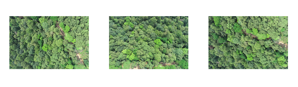
Some pictures of our dataset are shown below:
Detail
The segmentation model achieved the best results on ForestSeg‐T4, with an AP of 60.82%, AP50 of 64.71%, and AP70 of 57.13%, aligned with its highest classification accuracy of 71.32%. ForestSeg‐T2 followed with 69.23% classification accuracy and moderate segmentation scores. In contrast, ForestSeg‐T3 yielded the lowest performance across all metrics, suggesting that data quality and timing significantly influence model effectiveness.
These findings demonstrate that selecting the appropriate temporal interval, particularly one with high-resolution imagery and favorable conditions, is crucial for enhancing both classification and segmentation performance. Incorporating temporal diversity into training can improve the model's generalizability and reliability in long-term forest monitoring applications.
The detailed performance results across the four intervals are summarized in the table below:
| Method | Number of Parameters (M) | Inference Time (ms) | AP | AP50 | AP70 |
|---|---|---|---|---|---|
| Mask-RCNN (ResNet-50) | 43.05 | 8.3 | 30.63 | 46.23 | 26.17 |
| Mask-RCNN (SwinT) | 48.55 | 10.8 | 56.72 | 60.12 | 54.64 |
| Detectree2 | 62.86 | 11.4 | 22.33 | 49.71 | 20.22 |
| YOLOV11 | 22.33 | 7.5 | 38.30 | 52.78 | 33.51 |
| Ours | 10.81 | 6.2 | 57.01 | 62.21 | 55.32 |
| Forest Name | Classification Acc. | AP | AP50 | AP70 |
|---|---|---|---|---|
| ForestSeg-T1 | 65.37 | 57.01 | 62.21 | 55.32 |
| ForestSeg-T2 | 69.23 | 59.72 | 62.11 | 55.12 |
| ForestSeg-T3 | 59.01 | 54.92 | 57.28 | 50.01 |
| ForestSeg-T4 | 71.32 | 60.82 | 64.71 | 57.13 |
Terms & Conditions of Use
The datasets are released for academic research only, and are free to researchers from educational or research institutes for non-commercial purposes.